

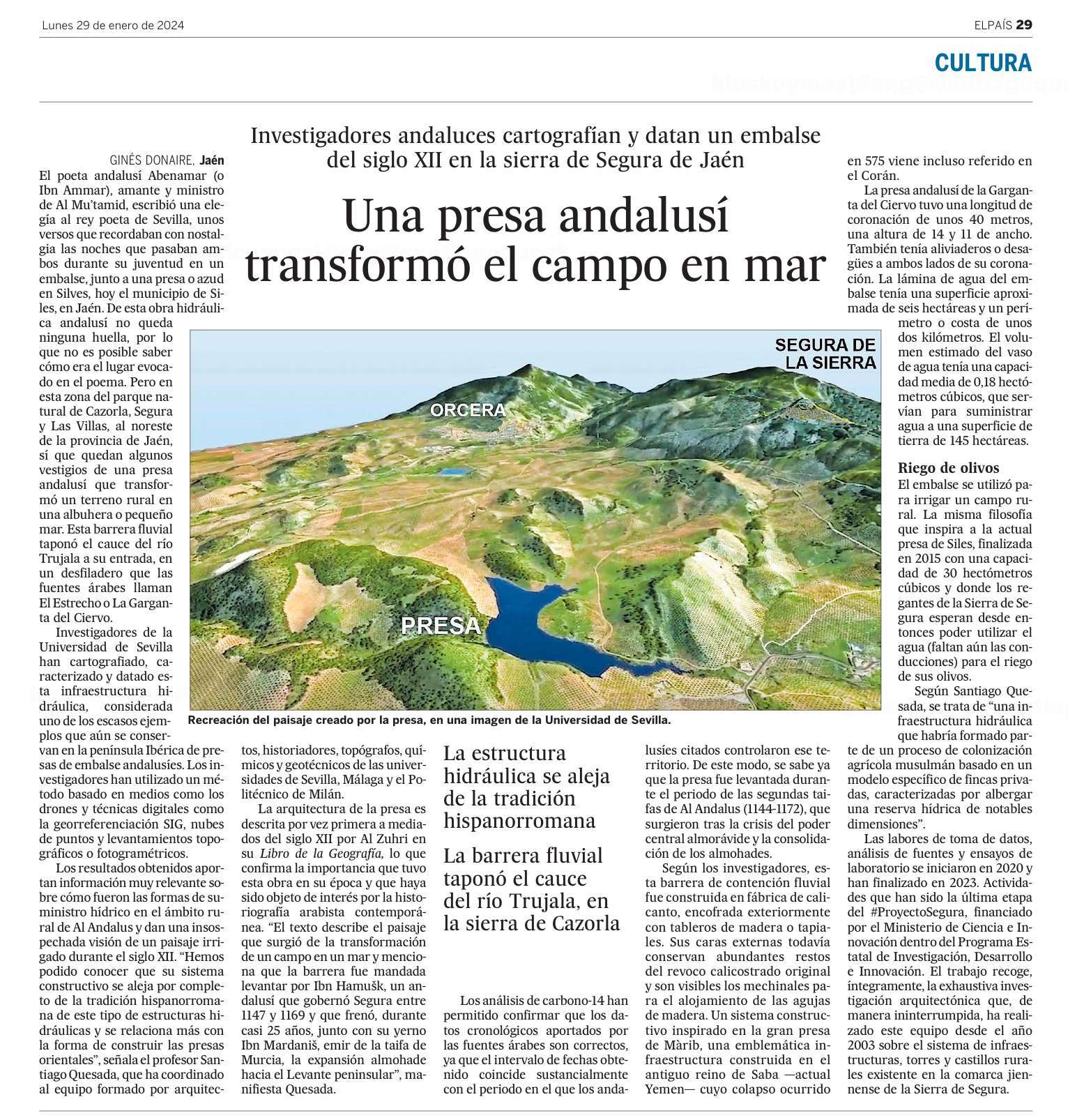
SEVILLE / January 17, 2024
A team led by the University of Seville and coordinated by Professor Santiago Quesada has scientifically mapped, characterised, and dated this mediaeval Muslim hydraulic infrastructure. The findings obtained have allowed us to know what this dam was for, what the water diversion and storage system was like, calculate the capacity of the reservoir, the surface of the irrigated lands, or the causes of the collapse of the dam. Essential knowledge is needed to understand what this work meant and what the landscapes associated with these artificial sheets of water in al-Andalus were like.
The well-known Andalusi poet and chess player Abenamar or Ibn ‘Ammar, lover and minister of al-Mu’tamid, had a hectic and intense life that he spent plotting and intriguing for various taifas of al-Andalus. In one of them, he wrote an elegy to the poet king of Seville in which he asked for forgiveness for his multiple betrayals and crimes. In poetry, he remembers, with nostalgia, the nights they both spent during their youth in a reservoir, next to a dam or weir in Silves. After a long journey through different territories, Abenamar was deceived and captured, around the year 1084, in the city of Segura (Jaén). From there, he is transferred to Córdoba, where he was acquired at auction by al-Mu’tamid. Abenamar committed a further act of treason after receiving his pardon, which led to the emir ultimately executing him with his own hands.
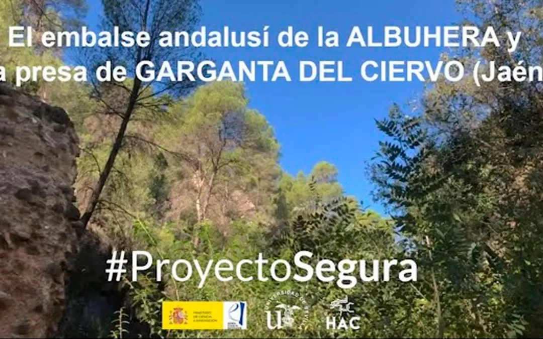
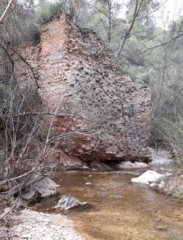
In Silves, there are no traces of the hydraulic work that Abenamar mentions in his poetry, so it is not possible to know what the aquatic place evoked in the poem was like. However, in the territory of Segura, in the current Cazorla, Segura, and Las Villas Natural Park in the northeast of the province of Jaén, there are still vestiges of an Andalusi dam that transformed rural land into an albuhera, or small sea. This river barrier blocked the bed of the Trujala River at its entrance into a gorge that Arab sources call the strait or Garganta del Ciervo. This ancient construction is an important source of primary information, useful for knowing how the Andalusian containment dams designed to store water resources worked. However, until now, it had not been the subject of structural studies, paramental analyses, or rigorous and detailed surveys.
The work of data collection, analysis of sources, and laboratory tests, both in the Albuhera reservoir and in the Garganta del Ciervo dam, began in the summer of 2020 and ended in 2023. Activities that have been the last stage of the #ProyectoSegura, financed by the Ministry of Science and Innovation within the State Research, Development, and Innovation Programme. This work includes, in its entirety, the exhaustive architectural research that this team has carried out uninterruptedly since 2003 on the system of infrastructure, towers, and rural castles existing in the Sierra de Segura.
For this purpose, a method based on means such as drones and digital techniques such as GIS georeferencing, point clouds, and topographic or photogrammetric surveys has been used. The innovative use of these tools and technologies means a total transformation in the acquisition of sources of knowledge about the numerous dispersed rural heritages that are still preserved in Andalusia. Above all, when there are no possibilities or economic viability to carry out archaeological excavations.
Al-Zuhrī describes the dam’s architecture in his Book of Geography in the middle of the 12th century, indicating the significance of this construction at the time. The text describes the landscape that arose from the transformation of a field into a sea. The Andalusi geograph states that Ibn Hamušk, an Andalusi who governed Segura from 1147 to 1169, gave the order to build the barrier. This chief stopped, for almost 25 years, together with his son-in-law, Ibn Mardanīš, emir of the taifa of Murcia, the Almohad expansion towards the eastern part of the peninsula. Due to this mediaeval description, this hydraulic structure has been the object of interest in contemporary Arabist historiography. The data obtained in this research answers many of the questions that this discipline has posed until now.
Presa andalusí de Garganta del Ciervo
The Carbon-14 analyses have confirmed that the chronological data provided by the Arab sources is correct, since the date range obtained substantially coincides with the period in which the aforementioned Andalusians controlled that territory. These results, crossed with those obtained in the study of materials, construction techniques, and stratigraphy, confirm that the dam was built during the period of the second taifas of al-Andalus (1144–1172), which arose after the crisis of power in Almoravid central and the consolidation of the Almohads.
This river containment barrier was built in a calicanto factory, externally formworked with wooden boards or rammed earth. Its external faces still retain abundant remains of the original calicostrate plaster, and the mechinales, places for housing the wooden needles, are visible. This construction system completely distances itself from the Hispano-Roman construction tradition of this type of hydraulic structure and indicates that the technology used is more related to the way of constructing eastern dams. Al-Zuhrī himself indicates in his description that the model of the Garganta del Ciervo dam was the great Màrib dam, an emblematic infrastructure of antiquity, built in the ancient kingdom of Saba —today’s Yemen— whose collapse occurred in the year 575 AD, and it is even referred to in the Koran.
The Andalusi dam had a crest length of about 40 metres, a height of 14 metres, and a width of 11 meters. As was the case with the Màrib dam, the Segura dam also had spillways or drains on both sides of its crest. The sheet of water in the reservoir would have an approximate surface area of 6 hectares and a perimeter or coastline that would be around 2 kilometers. The estimated volume of the glass of water had an average capacity of 0.18 cubic hectometers, which would serve to supply water to a land area of about 145 hectares. That volume of water would have been enough, today, to supply a population of 2,700 inhabitants for a year. However, the Albuhera reservoir was not used to supply water to any population but rather to irrigate a rural field. Like the Yemeni dam, the Andalusian dam had a dual purpose: on the one hand, to impound the waters of the Trujala River in a natural hollow in the land and, on the other, to divert them to land for agricultural or livestock use.
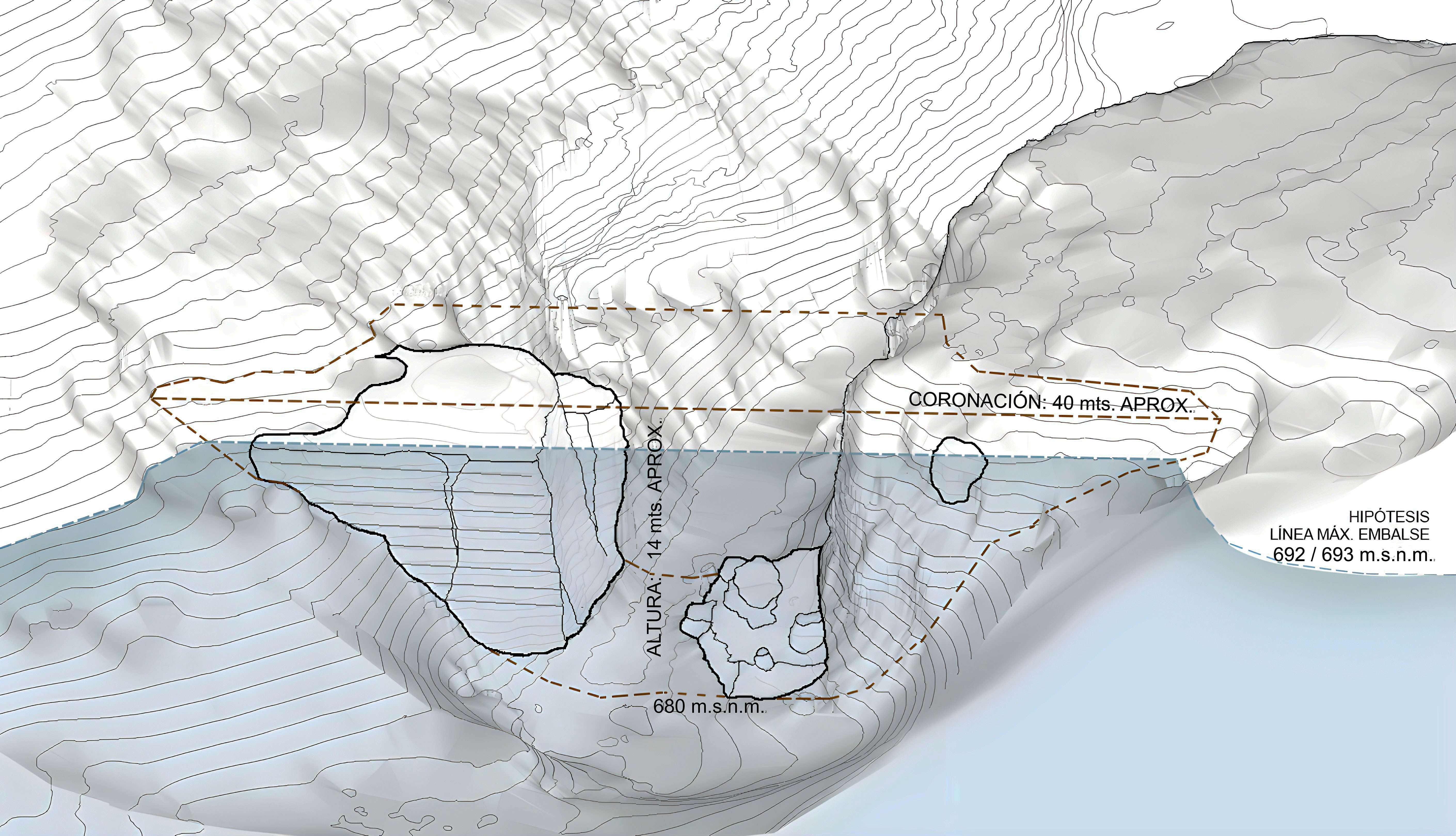
Volumetric reconstruction of the dam
According to Santiago Quesada, the meaning of the dam and the reservoir would have been to build water storage to irrigate land linked to a 12th-century agricultural operation dedicated to livestock, irrigated meadows, or dryland crops. A hydraulic infrastructure that would have been part of a Muslim agricultural colonisation process based on a specific model of private farms, characterised by housing a water reserve of notable dimensions. The small sea, or albuhera, would have been used to irrigate the land of a possible almunia existing in the area of Amurjo or Hamusgo, whose owner could have been Ibn Hamušk.
The work carried out on the hydraulic complex of the Garganta del Ciervo dam and the Albuhera reservoir contributes to providing fundamental keys to the knowledge of these Andalusi infrastructures and reveals very valuable data that sheds light on their functioning. The results obtained provide very relevant information about what the forms of water supply were like in the rural area of al-Andalus and give an unexpected vision of an irrigated landscape during the 12th century.
DISSEMINATION IN THE MEDIA
29/01/2024
Una presa andalusí transformó el campo en mar ![]()
![]()

Interviews
07/02/2024
Entrevista a Santiago Quesada sobre embalse de la Albuhera y el #ProyectoSegura
![]()
25/01/2024
Entrevista a Santiago Quesada: presa Garganta del Ciervo, embalse de la Albuhera y rafal de Amurjo![]()
22/01/2024
Un equipo de la US cartografían y datan una presa y un embalse andalusíes del siglo XII![]()
Bibliographic references
Artícle
El embalse andalusí de la Albuhera (al-buḥayra), la presa de Garganta del Ciervo (ḥalq al-ayyil) y el rafal de Amurjo (Hamušk). Una contribución a los paisajes irrigados del s. XII en al-Andalus
Revista Al-Qanṭara XLIV 2, julio-diciembre 2023, e17. ISSN-L 0211-3589. DOI: 10.3989/alqantara.2023.017
Book
Torres, castillos e infraestructuras andalusíes en la Sierra de Segura. Caracterización territorial, espacial, métrica y constructiva. Resultados del #ProyectoSegura
Santiago Quesada-García. Sevilla: HAC University Books. ISBN: 978-84-120786-4-0